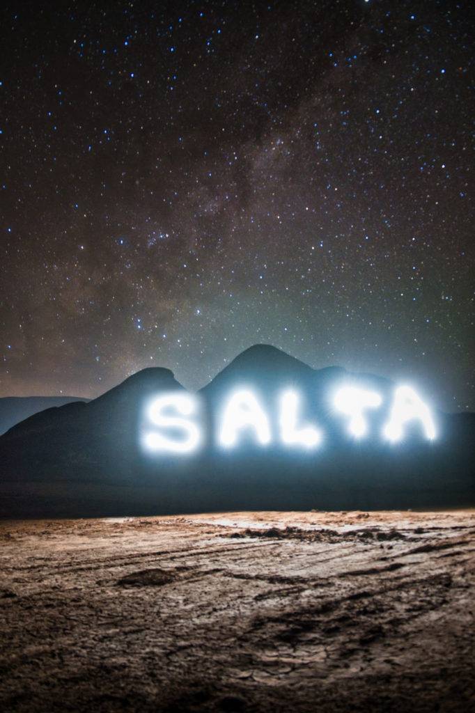
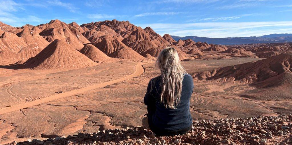
In Salta I went on a 3 day tour with Origins travel to Tolar Grande. We drove in a remote area and stayed in a town in the middle of the Andean dessert. It’s on the west side of Salta close to the border with Chile. I booked this trip 4 days in advance, later my friend Anna and Paul joined. It was an amazing trip. We saw many different landscapes from gorges to a life-less red dessert and lots of Salt flats. It felt like we were traveling on another planet. We got to see some interesting wild-life too, mostly on the road itself, like Guanaco’s, llama, Suri’s (Andean Ostrich) and more. At night we got to see the milk-way and falling stars.
Our road trip to Tolar Grande started early in the morning at 8 O’ clock, because we need to cross 360 km to reach Tolar Grande. We left the city of Salta and headed towards the west on the national route 51.
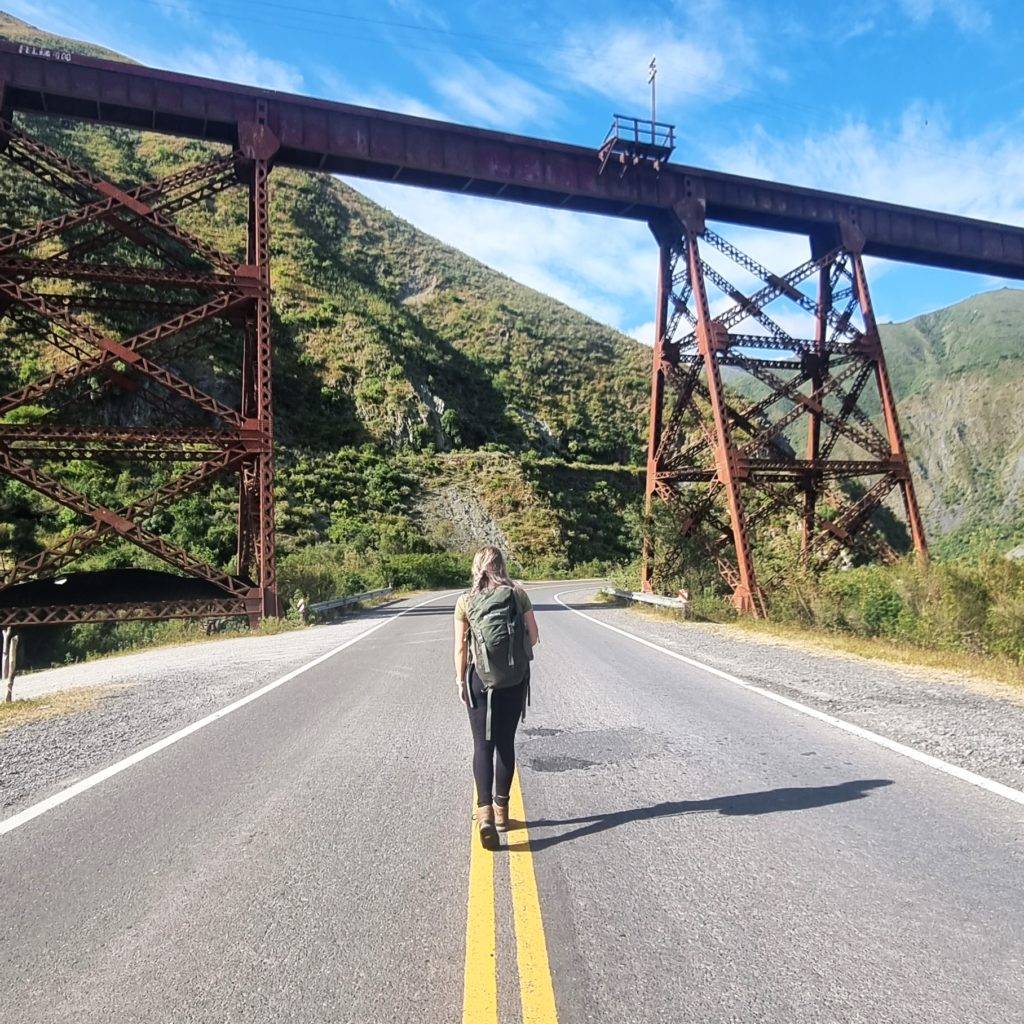
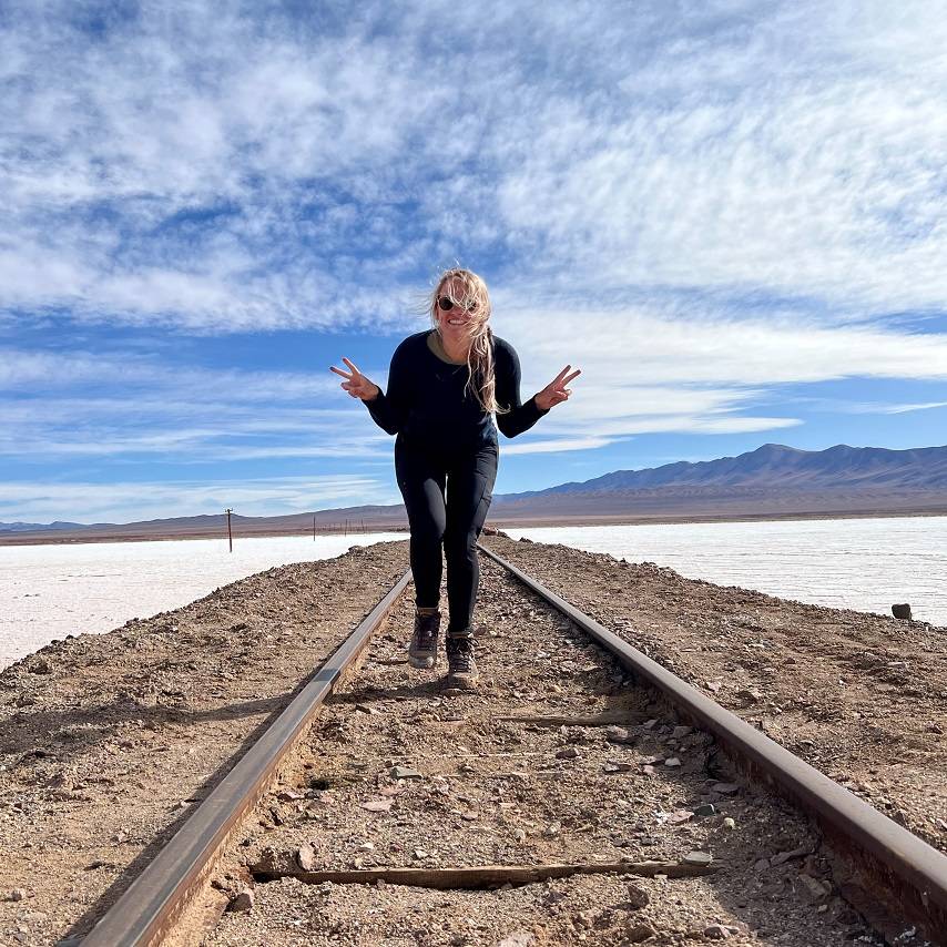
Tren de las Nubes
On our way to Tolar Grande we followed the tracks of the Tren de las Nubes – the train to the clouds. From here we could admire the major engineering feat done between the years 1921 to 1948. The railway was finally done in 1948 connecting the North of Argentina with Chile across the Andes. The railway is over 4,220 meters (13,850 ft) above mean sea level, what makes it the fifth highest railway in the world. The railway line has 29 bridges, 21 tunnels, 13 viaducts, 2 spirals and 2 zigzags. Because of the design decision not to use a rack-and-pinion for traction, the route had to be designed to avoid steep grades. The zigzags allow the train to climb up driving back and forth parallel to the slope of the mountain. It was very difficult to build the railway, because the railway needed to cross the high Andes with steep
The railway of the train to the clouds
inclines. There were 3 projects that tried, 2 quit. But one project continued, they did something really smart! They asked the help of the guanaco’s, cattle herders. Why them? Well because they’re used to cross the Andes mountains with their cattle to bring fresh meat to Chile….and cattle don’t like to climb. So they knew the valleys and what the best possible way is to cross the Andes mountains avoiding
unnecessary inclines. The road they took, would be the most efficient way to build a railway. They asked their help and it worked out! The railway was originally built for economic and social reasons, now it’s primarily of interest to tourists as a heritage railway. Just a part of the railway is open for public to take a ride on the Tren de las Nubes.
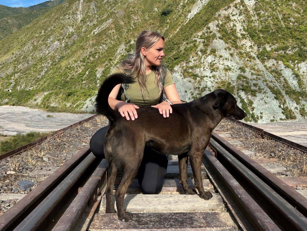
We made a stop at one of the bridges, unfortunately we didn’t got time to visit the famous bridge: La Polvorilla. But we saw another one and walked on it. I was always imaging and dreaming walking on a railway like this on my world trip, and I did it! We even had company of a dog.
A dog followed us on the railway for some back rubbing.
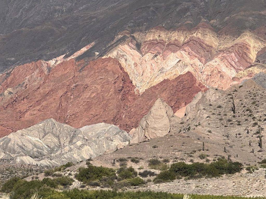
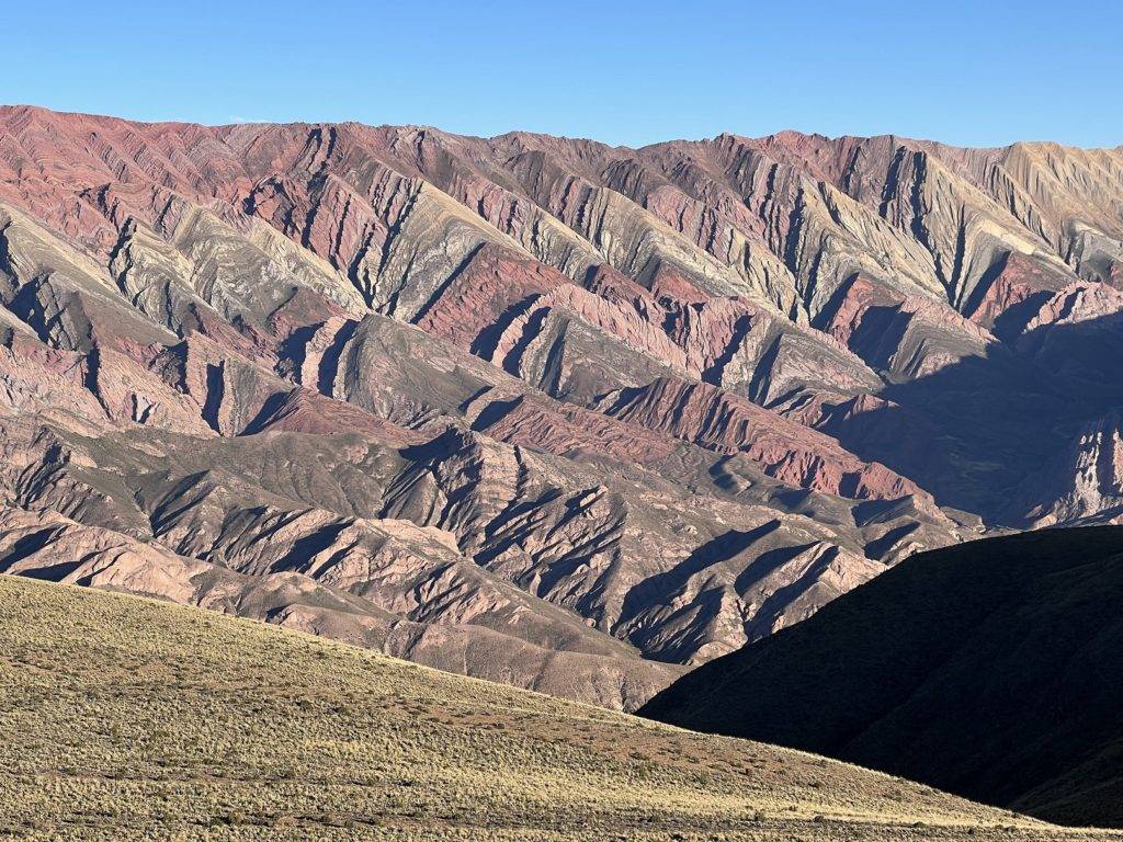
A colorful phenomenon
During our drive we saw many colors in the mountains. From blue-green to red-brown. I was wondering why these mountains have these colors, so I asked our tour guide – the best – Egdar to explain it to us.
These unique color ranges is a product of a complex geological history. There are mainly three reasons why these mountains have these colors. First it is caused by the movement of the tectonic plates. A long time ago the Nazca tectonic plate moved to the pacific plate, and that created the Andes mountain range from the ocean. Still there are tectonic movements, around 90 each year. The second reason these mountains have these colors is that the water in the rocks is dropping, creating marine sediments to move. The third reason is because the rocks contains iron. Iron gains and reduce oxygen and then it changes its color. The more red the rocks are the more oxygen it has, and it turns greener with less oxygen. This pheromone is called oxidation.
This colorful phenomenon is not the only one in Argentina, in fact it actually runs all the way along the Andes from Salta, Argentina through the Bolivian Altiplano and into Peru.
On half of our road trip we reached the highest point at 4650 meters high. I was feeling well, experienced no high altitude sickness. I was very pleased about that, a rookie like me from the lower lands reaching high altitudes with no problem.
Salty
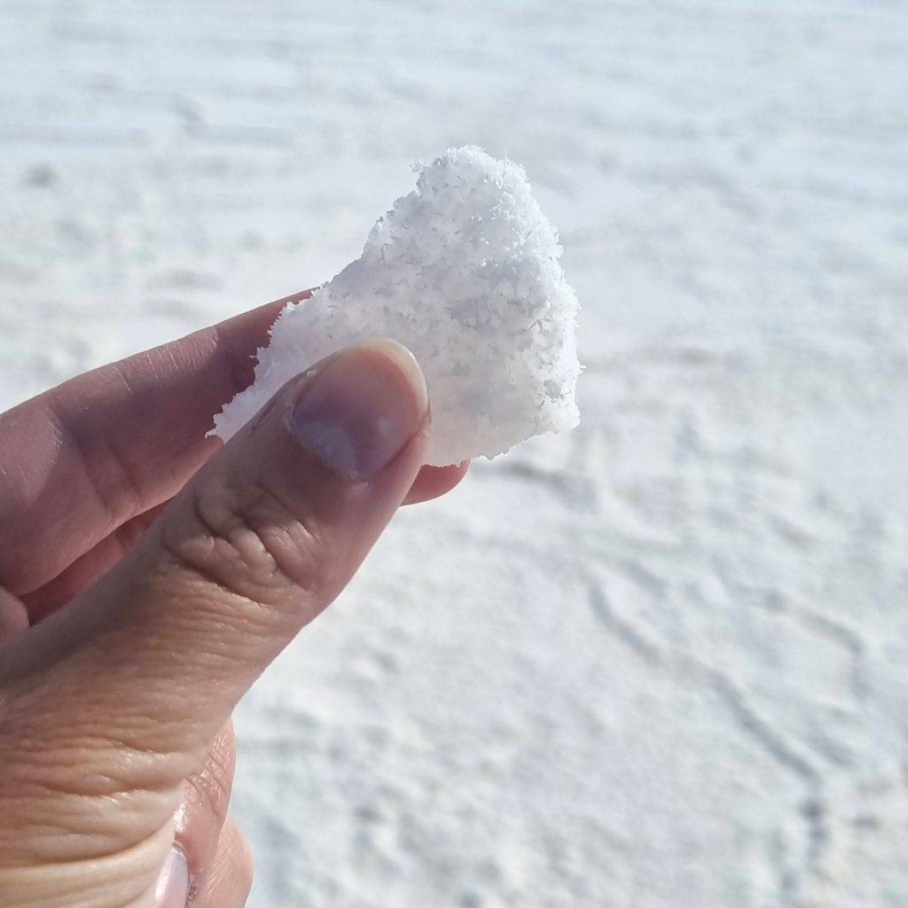
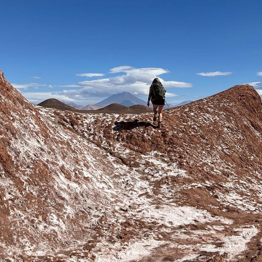
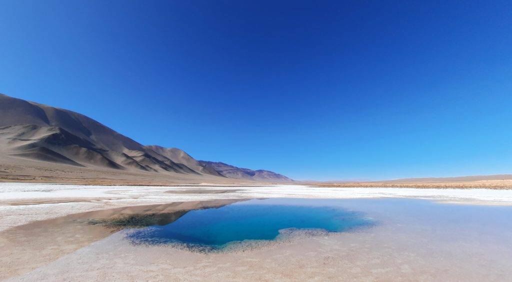
Later in afternoon we went to Pocitas and had lunch. It’s a place surrounded by salt flats. “Why does this area have so many salt flats?” I was wondering. Well, geography the salt flats are lower than other parts and this area is surrounded by high Andean mountains. The water drains from the higher parts of the Andes to the lower parts. The water can’t stain here for long because of the sun, the minerals are left over creating an area that looks like snow. We tried some of the salt. Later we heard that’s its not good to eat it and that you can get sick from it, because it doesn’t contain jodium (yet). Oops! I can still write this story, so we survived!
Natural salt
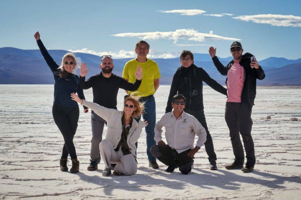
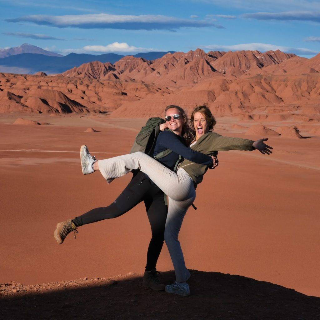
Group picture on the salt flats
Railway going through a big salt flat
Tolar Grande
We finished the day watching the sun set over the mountains in Tolar Grande, located at 3500 meters with just 150 inhabitants, this village emerged with the arrival of the railway line that used to connect: Salta, Socompa and the harbour of Antofagasta in Chile, when mining industry was at its peak. Tolar grande is named after the plant Tola that looks like round bushes of grass, you can see them everywhere around Tolar Grande. We stayed at a Communal shelter, like a hostel. was quite nice, the beds were clean and we had a nice warm shower. It was more than I expected from it.
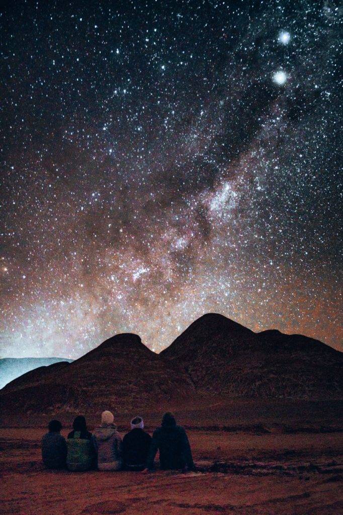
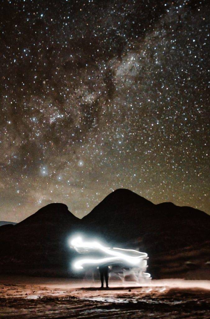
Stargazing
On our first night of our 3-day tour we went to see the stars and milky ways. We took a drive from Tolar Grande more to the border of Chili Atacama dessert. It was draw-dropping! I’ve never seen so many stars. There were so many stars, you don’t know where to look. It was so clear you could even see the milky-way. Everyone saw falling stars, but I always miss it …even back home. The others saw it four times when we were standing there. The others said we will stay there till I saw one, and I did! The first one in my entire life!! I can scrab that one down of my bucket list.
We had a good photographer among us (thanks Paul Turner) and got to make some amazing shots!!
Devil's dessert
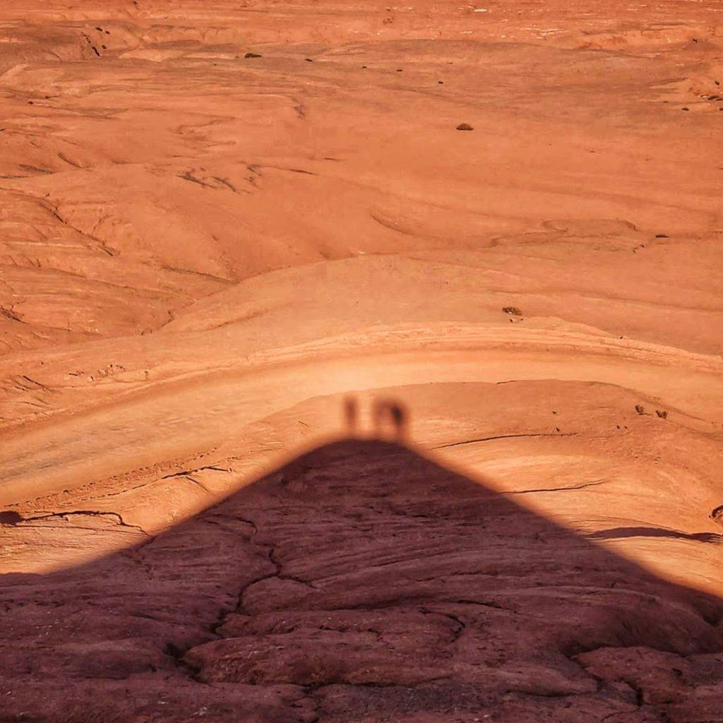
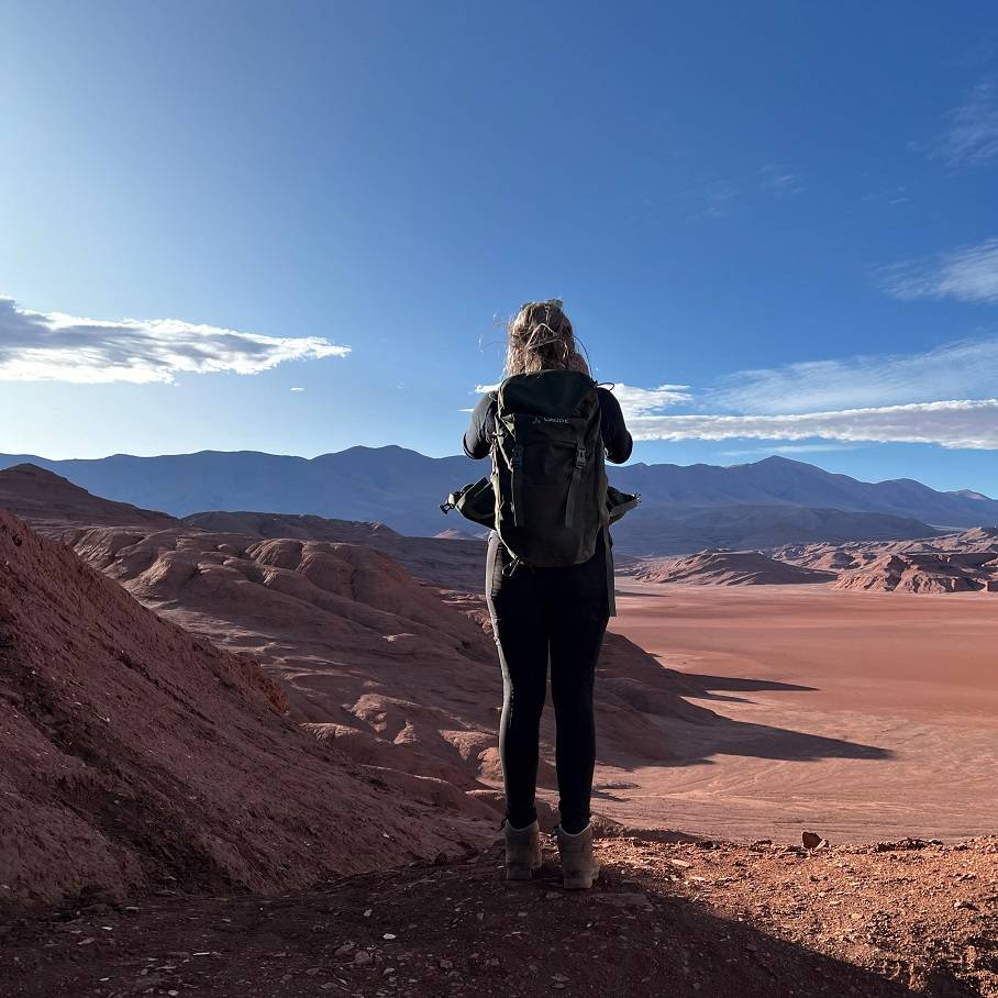
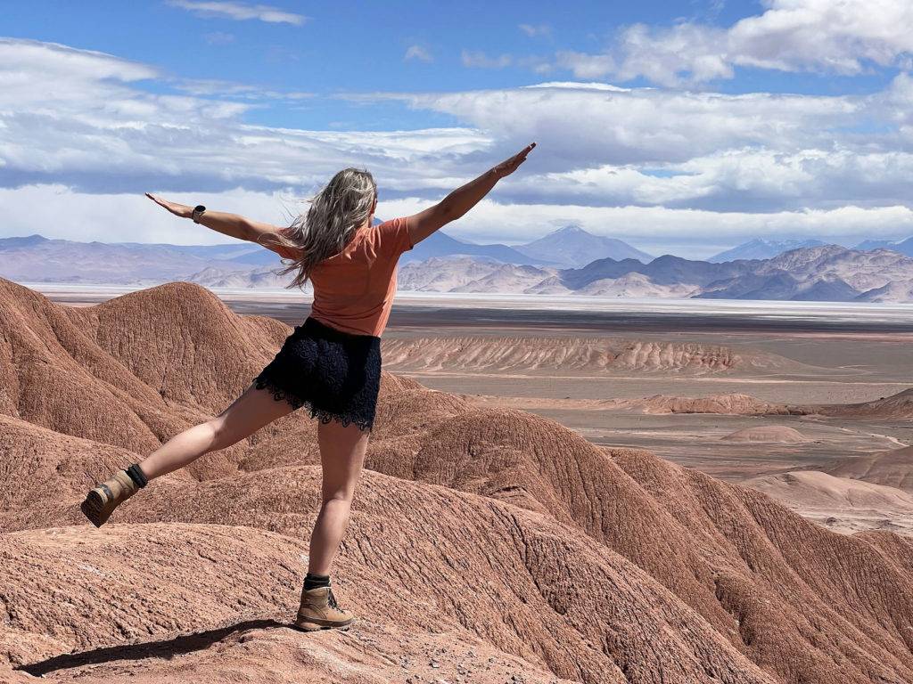
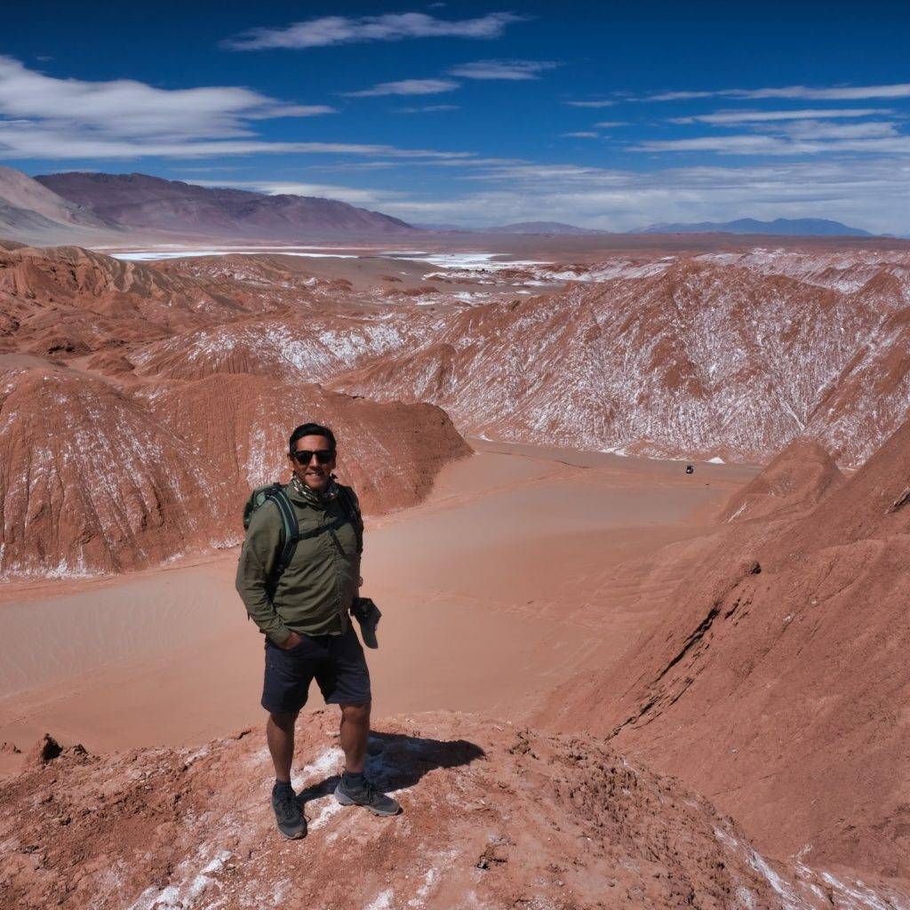
The next day our trip continued and we enjoyed the best views among volcanos, salt flats and the high dessert. Eventually we reached the Devils mountain range. When we drove through this area our tour guide put on the best playlist ever suited for a dessert trip. That made the experience twice as good as it already was. It felt like we were in a movie scene on a life-less red planet, like we were on mars. This reminded me of Mad Max the movie. It looked exactly like that! We headed to a spot from where we would take a hike up to a mountain viewpoint called ” el Arenal”. This is a viewpoint to see the seven volcanos in the Western Andes Mountain Range: Llullaillaco, Socompa, Aracar, Guanaqueros, Pulares, Salin and Arizaro. After that we slided down on dessert sand and could lift in the back of a 4×4 pick up car. This was a fun and lucky experience.
Sa shadow of us on the high dessert of the Devil’s mountain rage. !
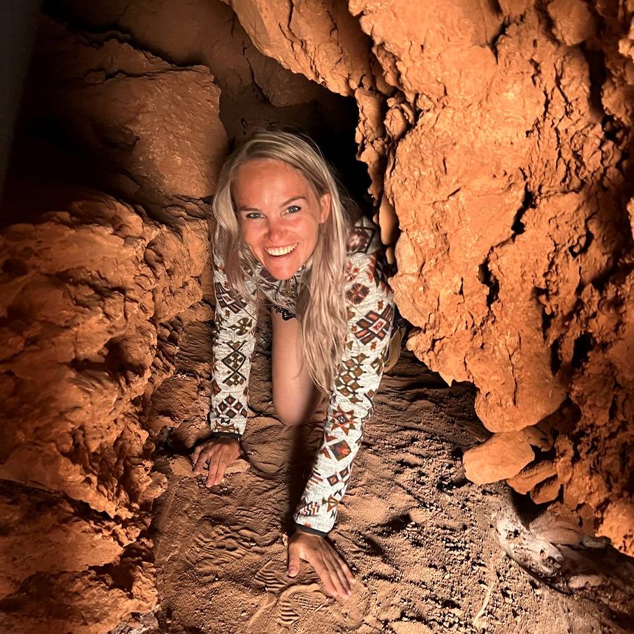
After that we had lunch in a cave. We saw a path going further into the cave and were wondering if we can go in. Edgar told us that we can go through the cave. “What the heck, why not?” I said to Anna. So we went through the cave, on our knees, our belly and in split positions to make it out of the cave. And we managed! Our clothes got a little bit dirty though…
Ojos de Mar
The second day we also took a visit to “Ojos de Mar”. An incredible place, not only because of its beauty but also for the elements contributed to science for a better understanding of the beginning of life on Earth and other planets like Mars. Researchers have found in this place, prehistoric microorganisms called stromatolites who are still alive and inhabited our planet 3.5 billion years ago!!
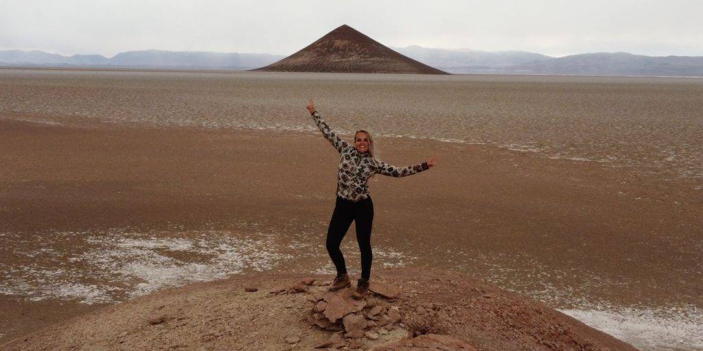
Cono de Arita
After a long drive through a very big Salt flat, the ” Arizona Salt Flat”, that was almost as big as the Netherlands, we reached the Cono de Arita. A striking formation similar to a volcano in the middle of the salt flat.
Animal crossings
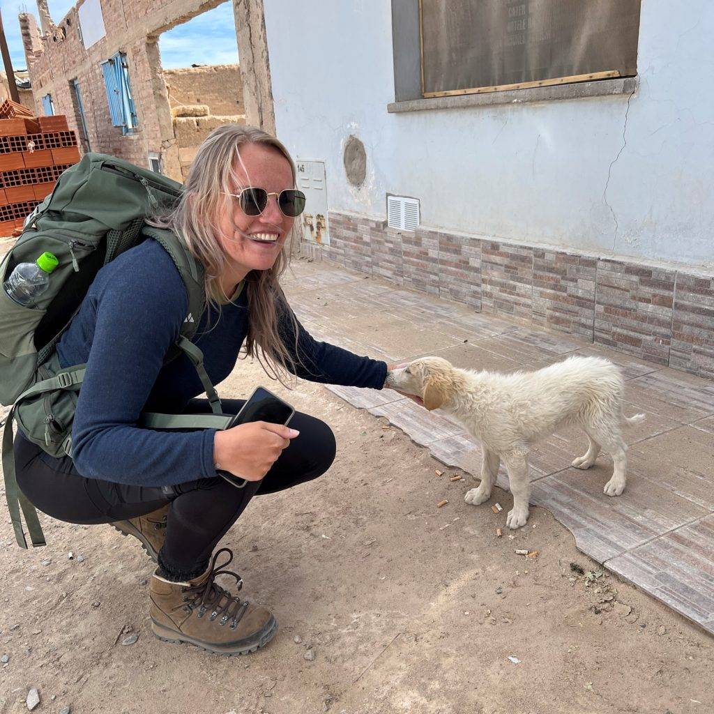
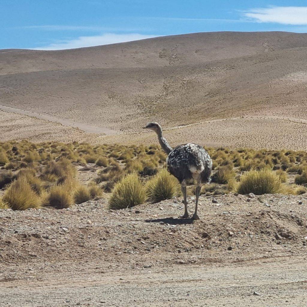
During our drives through the jungle, gorges, steppe, salt flats and dessert we encountered many animals: stray dogs horses, donkeys, guanaco’s, llama’s and Suri’s (an Andean ostrich). The Suri is extra special, they live in the high Andean dessert and represent earth.
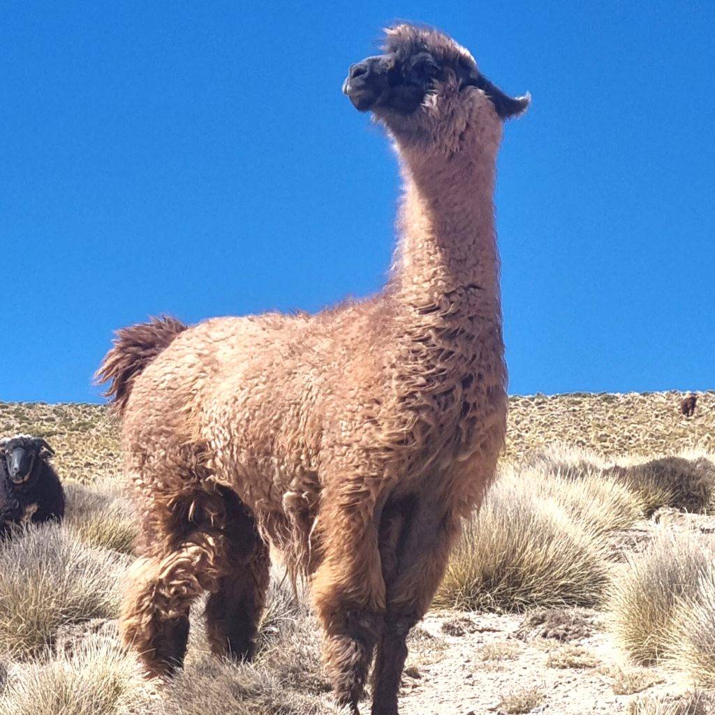
On our way back we stopped at a valley full of llamas. We sneaked to a group of them. One of them was sharp and was keeping an eye on us. When he was watching us, we stopped and when he turned his head we came closer – It felt like we were playing the game “peep behind the curtain”. When we were close to the group he walked towards us to show off and let us know who’s the boss. It turned our Llamas are quite big, so we got a little bit anxious. He was making noises with his teeth.
We were a bit afraid that he would spit on us….he was just 3 meters away. “How far can they spit?” We were asking each other. I looked it up later and it turned out they can spit up to 3-5 meters far. Ai! Luckily we got back home with clean clothes. But when we walked back to the bus he chased Anna for a couple of seconds, that was really scarry, I ran away around the bus and Anna ran and took shelter behind our tour guide.
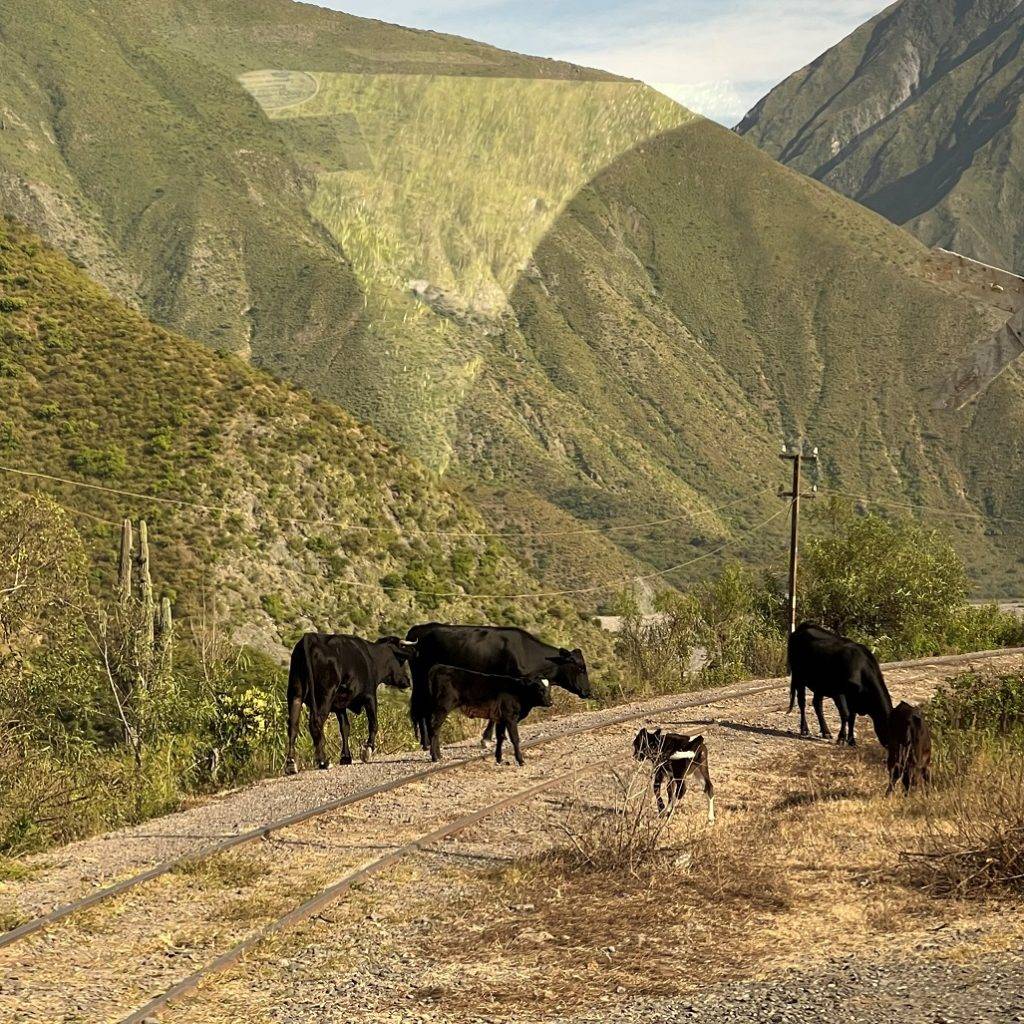
Cows on the railway
Suri, High Andean ostrich
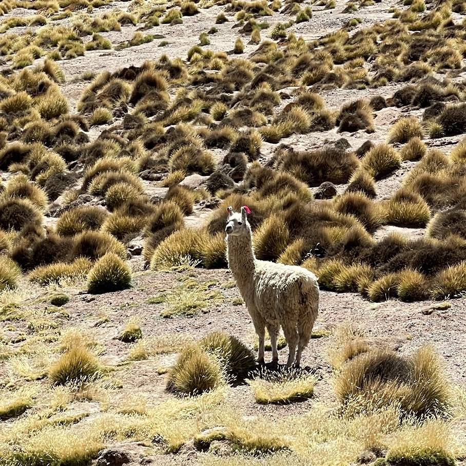
Lama
Angry Lama that chased us
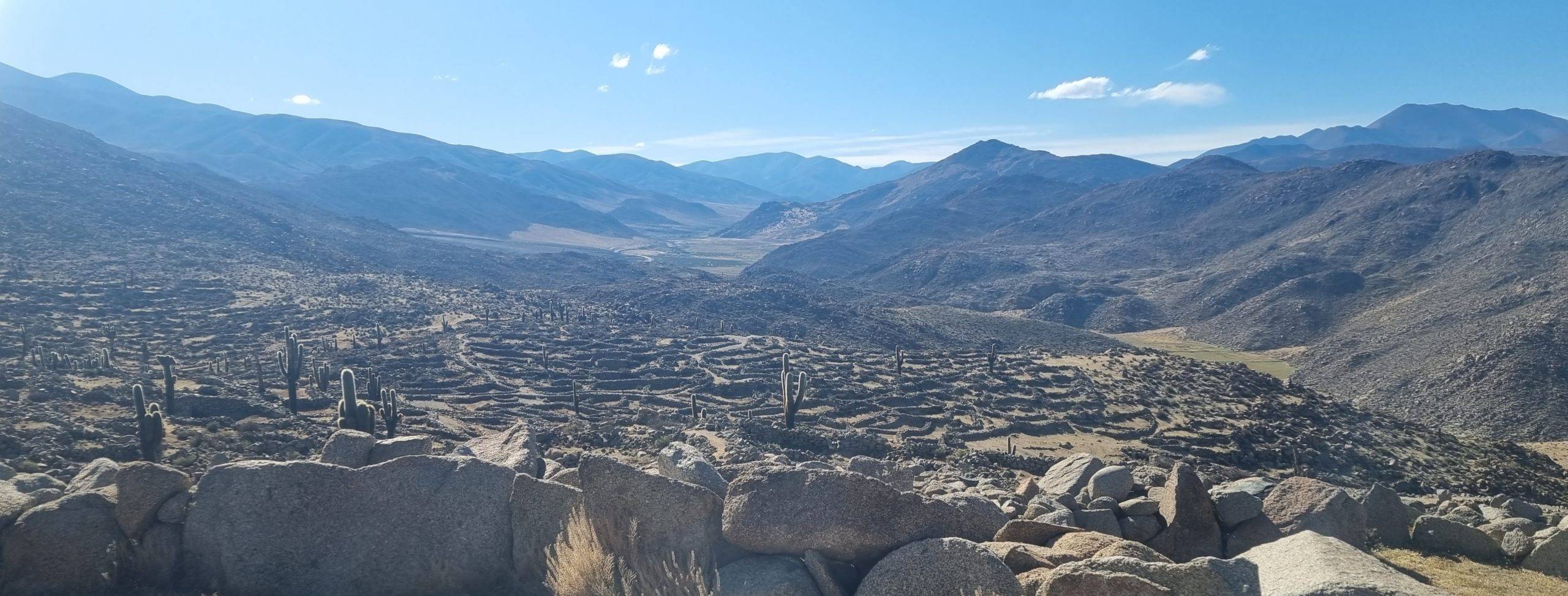
Archeological site
On our way back and halfway of our trip we visited an Archeological site where the Dastil’s lived, a settlement before the Inca’s in the pre-inca area. There were 450 houses and 1800 people lived here. This site was discovered by Eric Bowman, a swiss, he called this place a sea of stones. If you walk here you can understand why, the shape of all the houses together looks like waves made of stone. The houses looked different than the Inca’s: they were round built structures of rocks and they had a roof made of Llama or guanaco leather. The Dastil’s mainly livedfrom agriculture. They had a social community that was all about the activity they did and their knowledge. Knowledge was very important to them. That’s why the elderly people, who caried lots of knowledge, lived at the top of the mountain. This is also different than the Inca’s where the rulers where the most important people, not the wise elderlies. The Dastil’s left before the Inca’s arrived, they didn’t want to get influenced by them.
After another two hours we arrived back home. I was so tired of all the impressions, so I went to bed early.
Archaeological site of the Dastil’s
Special thanks!
Special thanks to Origins Argentina Travels! We had an amazing time with tour agency Origins Argentina Travels! The whole trip was well organized, Edgar was a very good tour guide who told us a lot about Tolar Grande, the environment and took us to some extra places and our driver Ceasar who got us back home safely.
If you want to read more about them or want to book a tour. Click on the link below to go to the website of Origins Argentina Travel