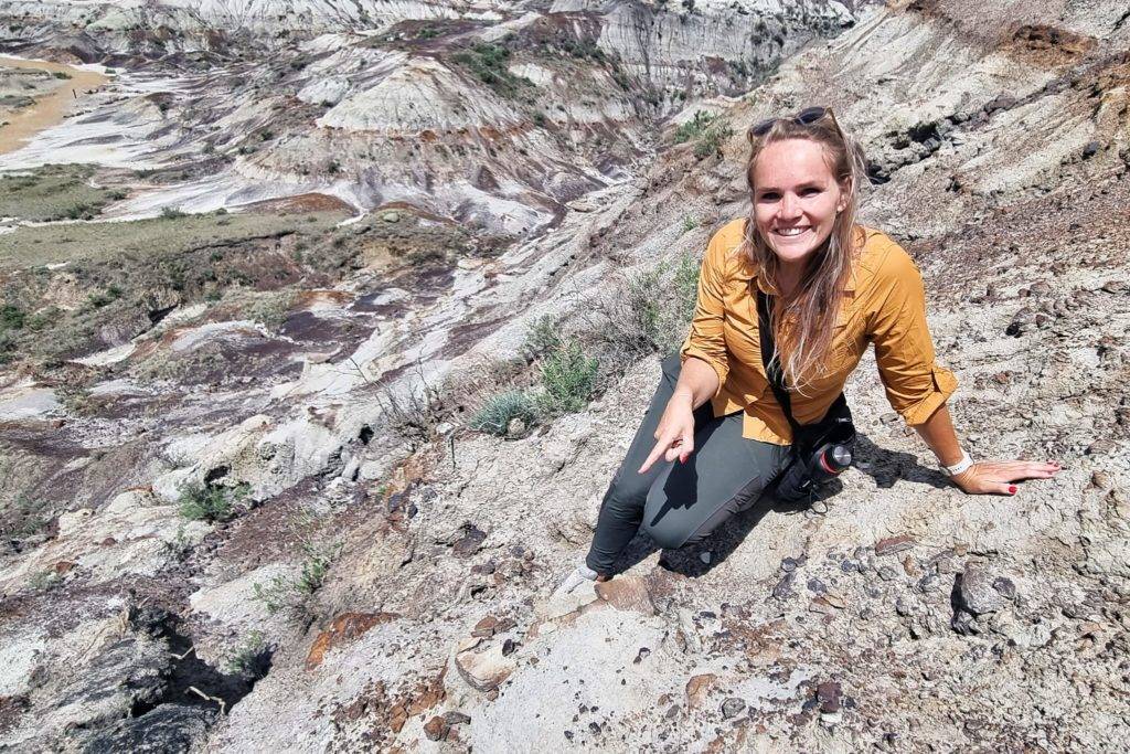
The Badlands, another part in the Alberta province with her varied landscapes. It’s an otherworldly landscape in the middle of the prairie with hundreds of sandstone hoodoos, ancient rocks and prairie dogs. There’s a lot of history here that goes way back in time. More than 75 million years ago it was a subtropical region with towering redwoods and giant ferns, where dinosaurs loved to live. Still there is lots to discover about its history. I’ll tell your more!
I’ve been here twice while visiting Calgary. I just love this place. It’s just so different than any other place I visited so far and a complete different world than the Rockies & Calgary. One day is not enough to visit this amazing place. You need to have at least 2 days!
The prairie
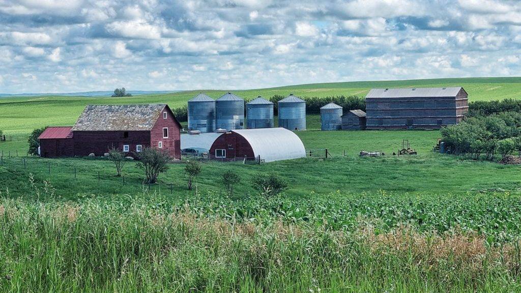
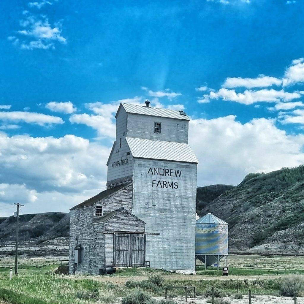
I drove to the Badlands through the prairie. I like driving through the prairie, it’s such an “(North)American” experience. Along the road you see big corn and grain farms. Most of them are connected to the railway so it can be deported right away. A smart system! But a necessity too, because the lands are just so big!
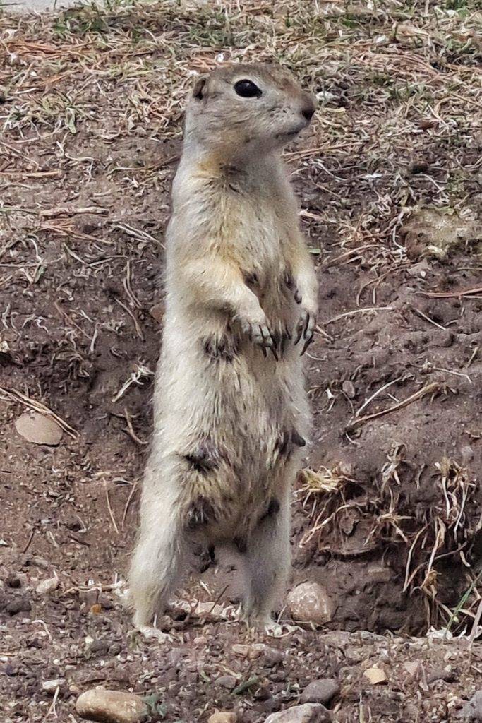
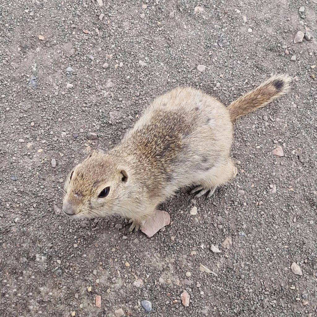
On the road and walking around this area I saw lots of cute prairie dogs. The first ones I saw were just standing in the middle of the road, I almost hit them by car. But luckily I still have my status of never hitting an animal on the road – I would like to keep it that way. I just love this cute little fellows. They make my day. While walking a hike some walked towards me and tried to climb on my pants, probably in the hope I’ll give them a piece of my cookie (Dad’s cookies, they’re the best!). When I gave one tiny piece of cookie they were fighting over it, and they can get quite spicy you know. But still so cute, so of course I made hundreds of pictures of them.
History land
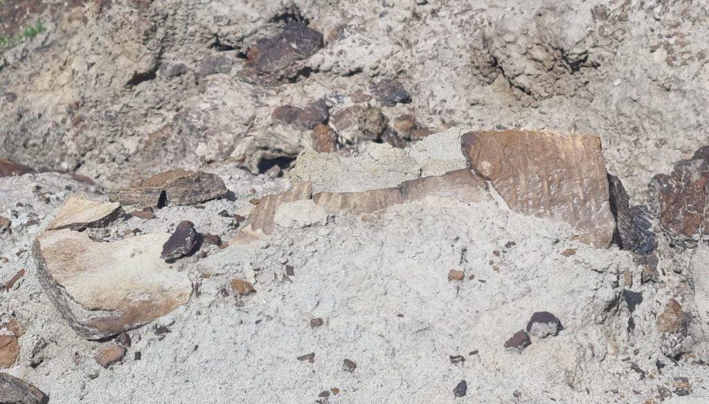
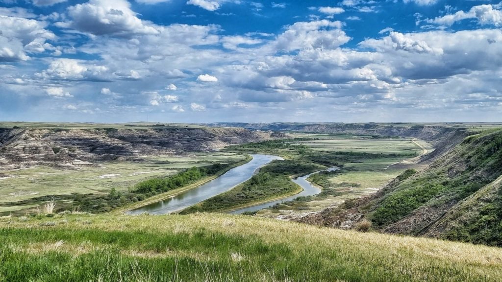
So 14.000 years ago, when the glaciers from the last Ice Age started to melt rapidly, the Badlands got its shape. As the ice melted, it stripped the landscape to expose the Lake Cretaceous sediments of the bearpaw and Horsehoe Canyon formations in which fossils of dinosaurs and other organisms are found. Each layer of rock in the valley walls is a page In the geological history.
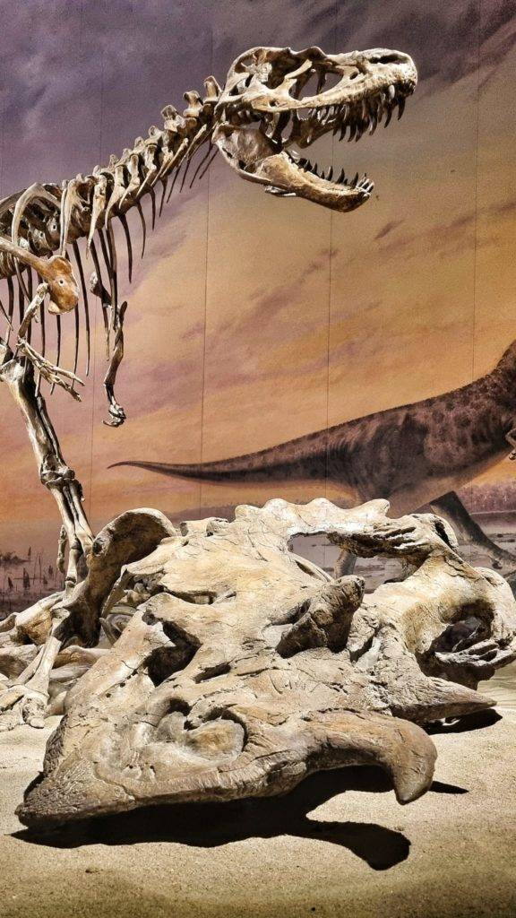
By studying the subtle differences between rock layers, scientists can determine changes in ancient environments. The rocks here point to a period 72 million years ago when Alberta looked much different than it does today with warm subtropical temperatures and seasonal rainfall. It was a rainforest rich of redwood trees and big ferns. This lush green corner of the world was home to fishes, salamanders, turtles, crocodiles, small mammals, and lots if dinosaurs. Half of the dinosaur remains discovered here belong to hadrosaurs, the horned ceratopsians, armored ankylosaurs, dome-headed pachycephalosaurus, bird mimic ornithomimids, swift dromaeosaurs, and carnivores like the Albertosaurus (a distant relative to Tyrannosaurus rex).
Most of Alberta’s dinosaur remains are found in the Badlands and river valleys where cretaceous-aged -sedimentary rocks are exposed. The rock layers deposited after the dinosaurs became extinct were scrapped away by the glaciers of the last ice age. Today, wind, rainfall, and snowmelt continue to erode the Badlands, exposing more fossils with each passing season.
I was wondering why this land is called the Badlands. Well, I found out that these lands are not very hospitable for agriculture and is difficult to cross on foot or horseback particularly during wet season. In south Dakota, the Sioux called this type of landscape “Make Sico”, which literally means: land bad. Early French-Canadian fur trappers called this area: bad lands to cross. So that’s how it got its name.
Dino fossils!
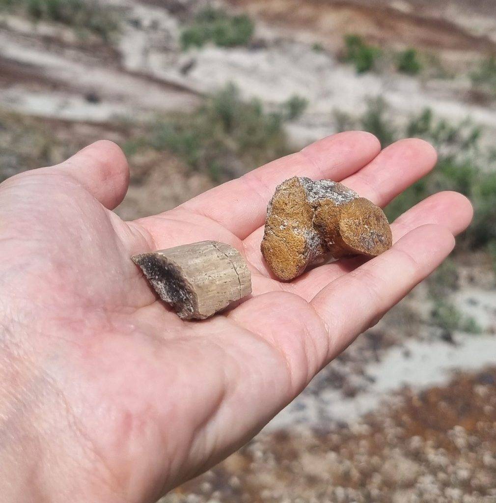
Then I drove to the Tyrell museum. Without actually going to the museum you can take up some great hikes around the area. I took the Badlands interpretive trail. A nice short hike with lots of information boards about the Badlands area. A great start of a little road trip. While I was walking on the trail I saw a women looking for something. I greeted her and asked what she was doing. She was looking for Dinosaur bones and fossils. I read about that it was possible to find fossils, but I didn’t believe it, it’s next to a museum and they probably found everything already. Well she, her name is Amanda, explained me that because of erosion and the waterflow of the river, more bones and fossils get exposed. So there’s a lot more to find! She picked two bones for me in just a couple of seconds.
These are small ones that the museum won’t be interested in. She showed me a jaw an Edmontosaurus, she took a picture of me with it. Their teeth look totally different. The bones are not typically white, ..because they’re so old it looks like a brownish stone. But if you look good you can see a bone structure. You just need to know how to look for it, said Amanda.
It’s so impressive that this is a UNESCO world heritage site where digs are still on-going and it’s open for the public.
The Royal Tyrell museum
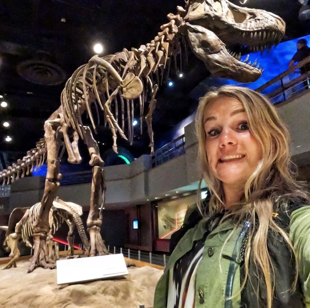
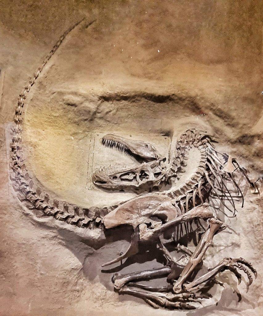
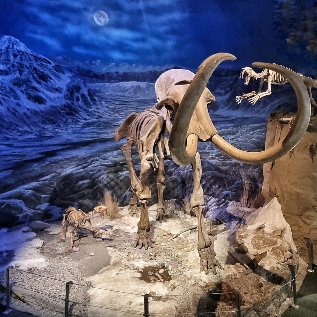
After the hike in de Dinosaur Provincial park I went to the museum. The Royal Tyrrell Museum is a paleontology museum that houses one of the world’s largest displays of dinosaurs. Young or old, this place is an incredible place to learn about the massive creatures that use to roam this planet.
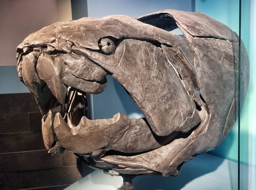
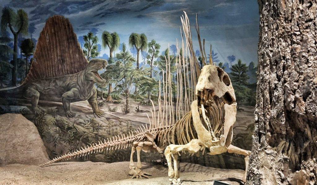
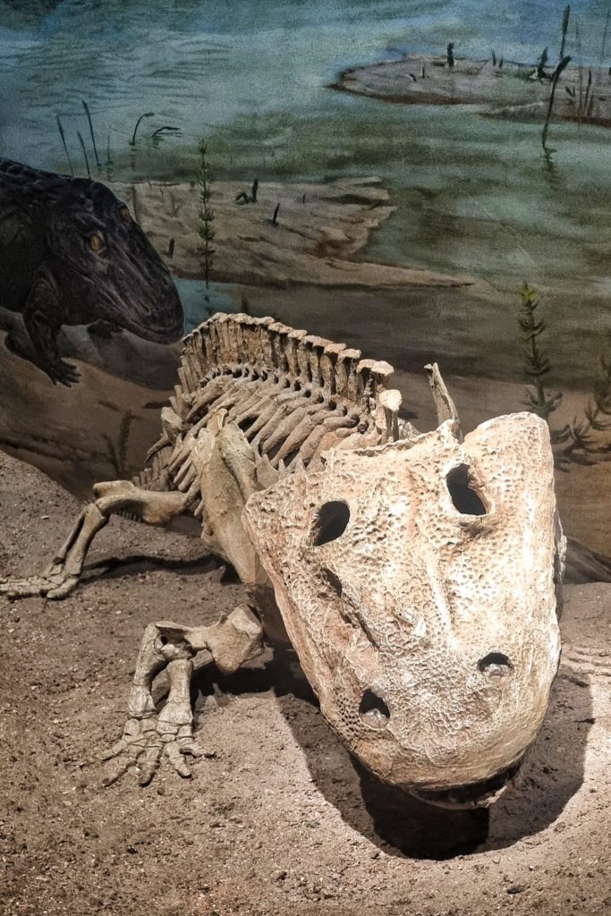
The museum does not only explain you about the dinosaur age, but it starts right at the beginning: the big bang! After the Big bang other creatures made our earth their home, way before the dinosaur age. First there were mostly small sea creatures (Archean & Proterozoic era) and then bigger sort-like-reptiles appeared (Paleozoic era). You see some of them on the first three pictures below.
And million of year later the Mesozoic era, dinosaur age, started. And then our era started, the Cenozoic Era, including the ice age and our ancestors the homo habilis.
Dino's, Dino's, Dino's
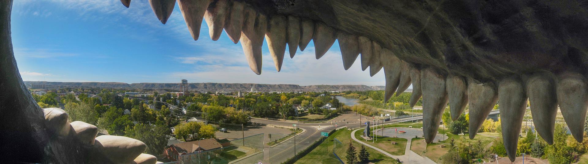
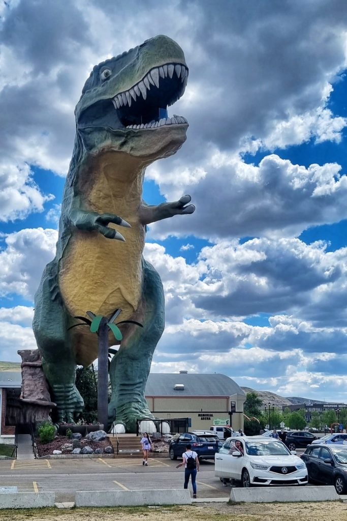
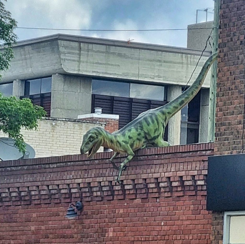
Not only in the museum or in the ground there are dinosaurs, they are everywhere in town!! On top of buildings, on street signs, as home decoration and many statues all over the place. One of them you can’t miss: the world largest dinosaur in the center of Drumheller. And you can even climb in it and look over the city from its mouth.
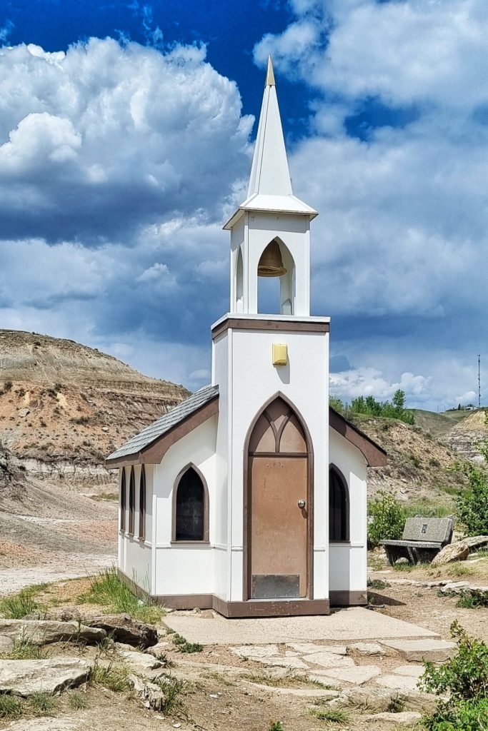
Everybody just loved Dino’s up here! The roads are even named after them. One of the main roads is the North and South Dinosaur trail. These roads take you all around town and is excellent for a little road trip to explore this area. It’s starts at the World largest dinosaur and brings you to the Tyrell museum, to many sightseeing’s (like the cutest little church) and viewpoints over the Badlands. You cross the river with the Bleirot ferry from the North dinosaur trail to reach the South trail that brings you back to Drumheller.
Hiking the Badlands
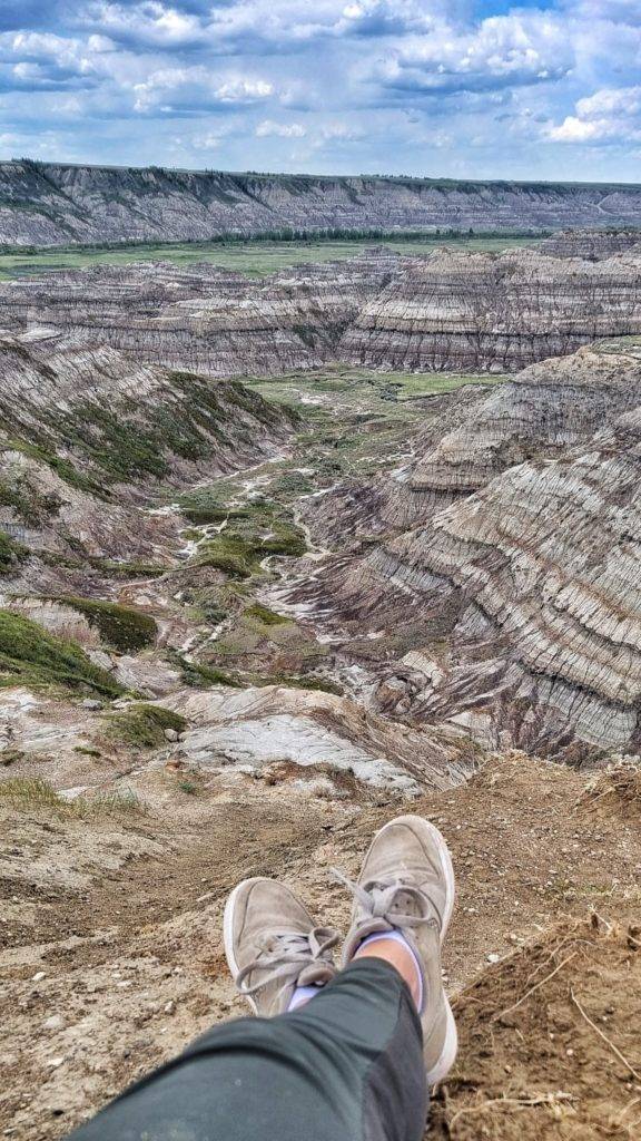
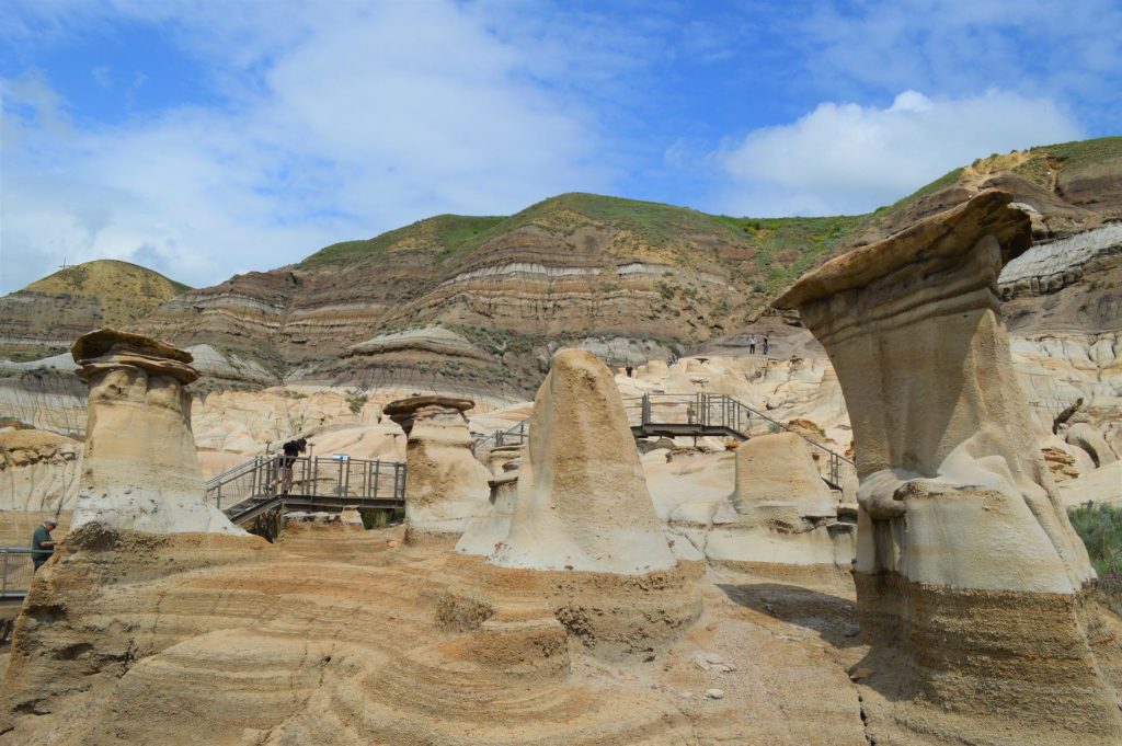
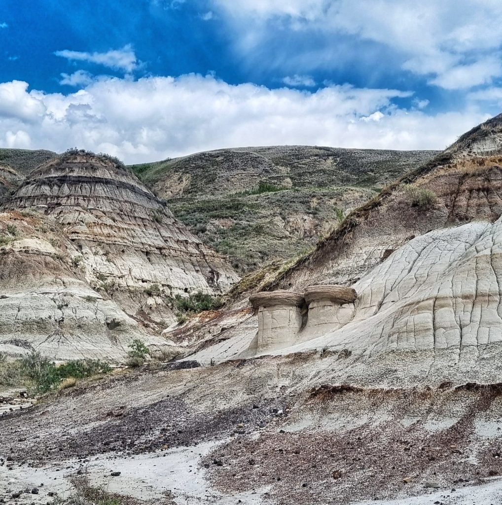
The Badlands offers some great hikes. One of the first hikes to recommend and before you enter Drumheller, is the Hoodos trail. It’s a popular hike between a landscape full of Hoodoos. Hoodos are eroded pillars of soft rock topped with a mushroom-shaped cap. The hard rock cap protects the softer pillar from eroding as quickly as the surrounding ground. Hoodoos are found throughout the Badlands in many different sizes. They are extremely fragile.
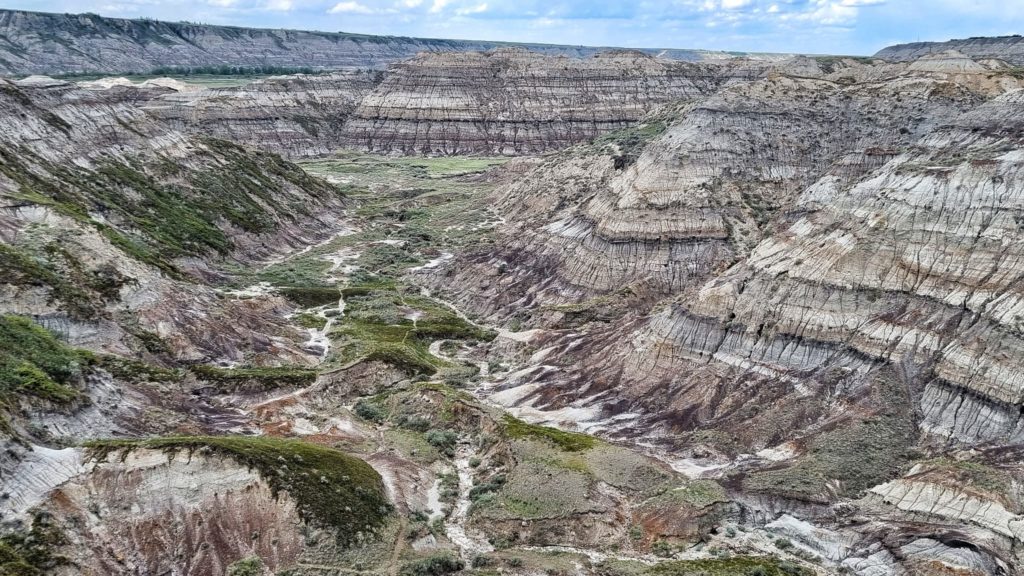
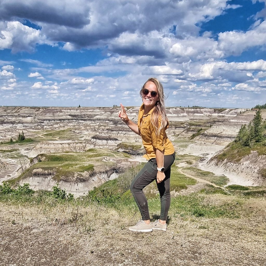
There are many viewpoints like Horsethief canyon and Horseshoe canyon where you can see how the Badlands have formed, not only hills and coulees but also flat-topped benches: covered with grasses native to this part of the country. Benches form when sandstone layers are iron-rich, making them resistant to erosion. At Horsethief and Horseshoe canyon you can go on several hikes, most of them are around one hour. Ideal to combine with a road trip or a visit to the museum.
Land of Coal
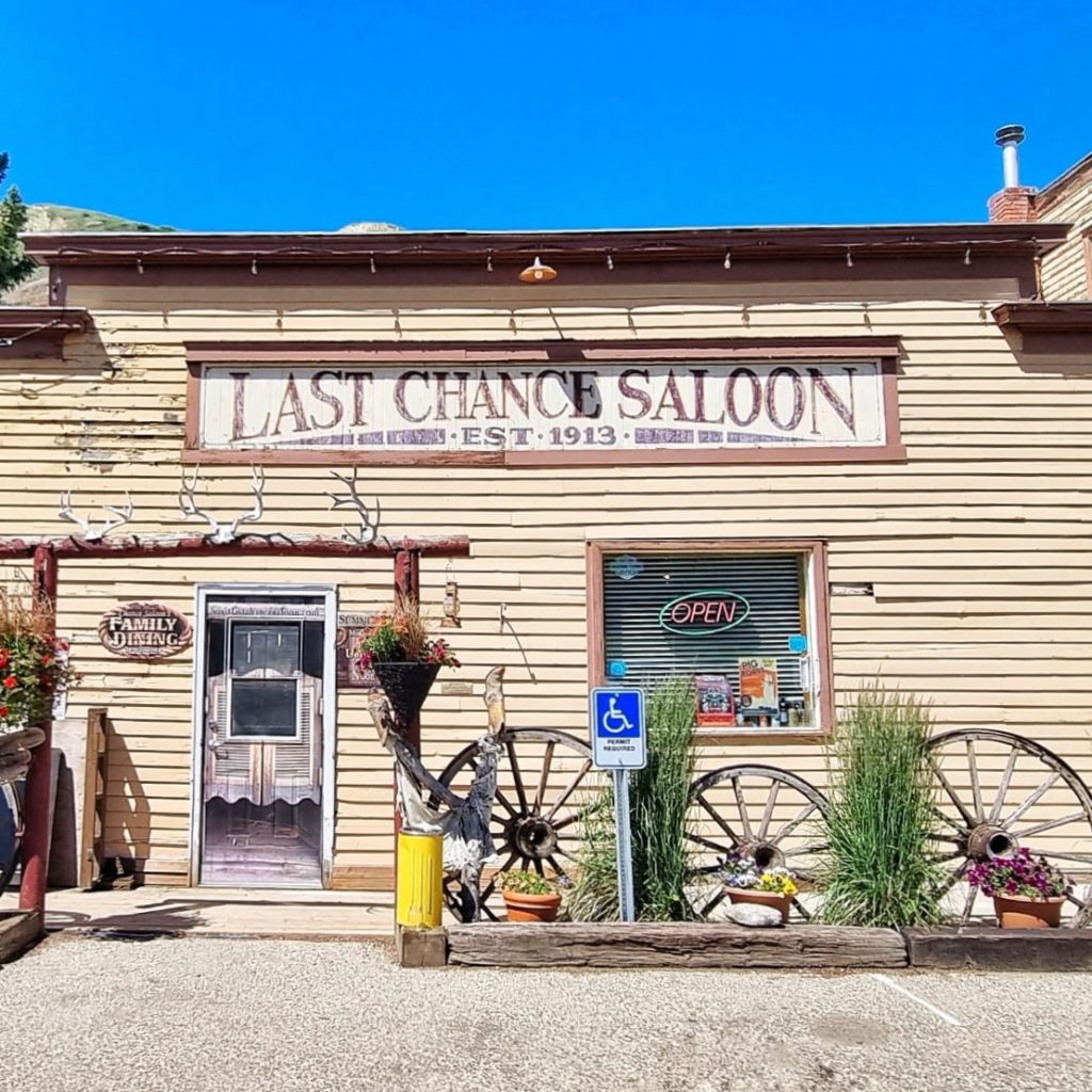
But there is more history in these Badlands. Though Drumheller has since become world-renowned for dinosaur fossils, it was the abundant coal deposits within the surrounding Badlands that gave life to the community. More than 130 coal mines operated in the valley between 1911 and 1979. But now all the coal mines are closed and towns got left behind. One of them is Wayne, located on the southeast of Drumheller. You need to cross many (11) cute steel bridges with wooden planks to reach Wayne… An experience on its own. The “Last Chance Saloon” and the Rosedeer Hotel are the only structure remaining of the old mining days and worth a visit! Inside the saloon you will find walls covered with old black & white photographs of Wayne and the coal mine plus a small collection of
mining gear. A must do is a visit to the Atlas Coal mine where Drumheller’s booming coal mine history comes alive. Here you can have a “mining experience” where you can climb the tipple, ride the mine train and go underground. You can hear stories of men who mined the black on a fascinating interpretive tour.
My guide for your Badlands trip
I recommend to go to the badlands for 2-3 days. Take the first day to explore the landscape and learn more about the dinosaur history. Take the second day to learn more about the coal mine history and explore ghost towns.
Day one
Start with a nice walk at the Hoodoos trail: 5.6 km, 1,5 hour.
Drive up to Drumheller for a cupcake and a coffee/thee at Ole Café.
Climb to the big dinosaur’s mouth for 5 CAD (family of max 8 15 CAD total).
Head to the Royal Tyrell museum. Free parking. From here you can take the badlands interpretive trail. Duration 30-60 minutes.
Dinosaur roadtrip: take the North Dinosaur trail up to Bleirot ferry (free service) and drive back on the South Dinsosaur trail. Make sure you stop at the little church, Horsethief canyon, Orkney viewpoint.
Day two
Drive to Atlas Coal Mine National Historic Site and learn more about the mining history. Duration: 3 hours.
Drive to Wayne over 11 wooden bridges, and walk through the ghost town. Grab dinner at “Last chance saloon” and learn more about the old wild west town.
Go to horse shoe canyon and take the trail: 4,2 km, duration: 1 h 11 min. At the end enjoy the amazing sunset over the canyon from the viewpoint.
If you have time left, make a visit to Carbon, also an old mining town.